Ecuador Touts Flood Prevention Measures Amid Record Rains
President credits planning and infrastructure investment for mitigating damage.
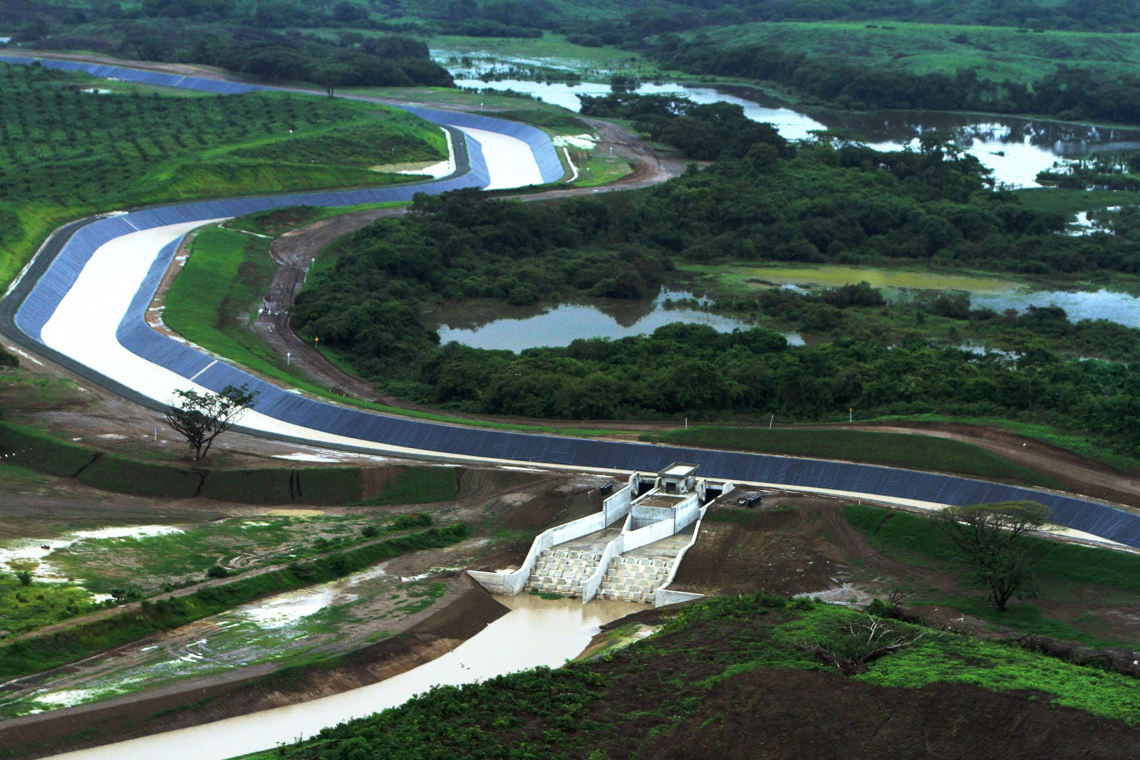
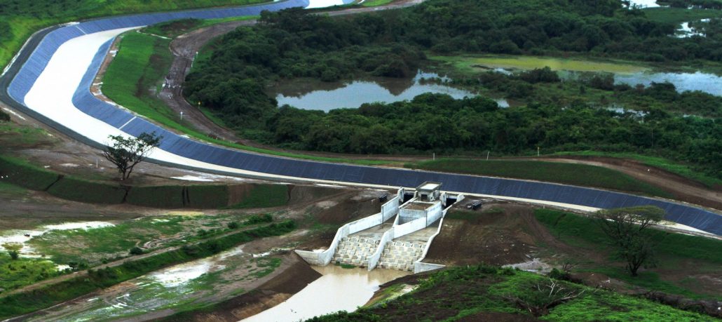
The Daule-Vinces water transfer scheme in Guayas and Los Rios provinces is one of Ecuador’s national water projects to control irrigation and floodwaters. Photo by César Muñoz / ANDES via Flickr Creative Commons.
The Rundown
A localized El Niño continues to batter countries along South America’s Pacific Coast, but communities in Ecuador have been relatively unscathed compared to those in neighboring Peru. When asked why, government officials, including President Rafael Correa, point to a series of dams, reservoirs, dikes, and break walls installed in the Cañar, Guayas, and Naranjal river basins that divert water away from towns and farmland. Still, emergencies caused by floods and landslides spiked in Quito following record rainfall, and the government declared disaster areas in four provinces this month.
“Look how much it’s impacting Peru, the same storm that we are suffering ourselves. This isn’t about luck, it’s about planning, hard work, and good investment, which provides the best savings. This is saving us hundreds of millions of dollars.” — Rafael Correa, president of Ecuador, praising his country’s flood defense systems during a visit this month to El Triunfo in Guayas province. Ecuador built the infrastructure in response to a strong, global El Niño in 1997 and 1998 that inundated vast areas of Guayas and Cañar provinces. A coastal El Niño this year has rained destruction on Peru, but there is comparatively little damage in Ecuador.
By The Numbers
45,000 hectares flooded in Cañar province and the Naranjal River Basin during a 1997-98 El Niño. The event killed 286 people in Ecuador.
349 kilometers of protective dikes are part of six major flood control projects designed in response to the 1997-98 El Niño. The projects include a 23-kilometer bypass canal that can divert 1,500 cubic meters of water per second into the Gulf of Guayaquil. Together with the dikes and a series of pumping stations and reservoirs, the canal protects 655,000 people and 285,000 hectares in the Cañar, Guayas, and Narangal river basins, according to Ecuador’s Public Water Company.
18 people killed by floods and related disasters during Ecuador’s rainy season this year. The rains also injured more than 1,200 people, affected more than 8,500 families, and destroyed 144 homes and seven bridges.
4 provinces declared disaster areas by the Ecuador government this month. They are Esmeraldas, Guayas, Manabi, and Santa Elena. An “orange alert” was issued for the provinces of El Oro, Loja, and Los Rios, activating local emergency operation committees to prepare for potential disasters.
493 emergency incidents reported in Quito this rainy season, including floods, collapsed houses, and fallen trees, according to the city’s Emergency Operations Center.
30 to 40 percent reduction in productivity at several public work projects in Quito due to delays caused by heavy rains. The rains also forced contractors to use drainage and pumping systems to reduce water accumulation in the Quito Metro, which is under construction.
Science, Studies, And Reports
More than double the normal amount of rain fell in March across Azuay, Cotopaxi, and Pichincha provinces, and rainfall reached 73 percent above normal in Guayas province, according to data released this week by the Secretary of Risk Management. Several stations in Quito, located in Pichincha province, registered record levels of rainfall this month. By comparison, the 1997-98 El Niño dropped nearly 10 times the average amount of rain on Ecuador and Peru.
Under long-term climate change scenarios, scientists expect rainfall extremes to become more common along the coasts of Ecuador and Peru, raising the risk of floods and landslides. At the same time, shrinking glaciers in the Andes could harm Ecuador’s páramos grasslands, which help store and regulate water flows. Glaciers in the tropical Andes shrank an average of 30 to 50 percent over the past four decades.
On The Radar
Heavy rains and storms are expected to continue through the end of the month, particularly along Ecuador’s central and southern coast. The national committee that tracks El Niño conditions will meet again to update forecasts on March 30.
Resources And Further Reading
Rafael Correa Explains Why the Impact of Heavy Rains is Lower in Ecuador [VIDEO] (Diario Correo)
3D Video of the Cañar and Naranjal Flood Control Projects (Public Water Company of Ecuador)
Ecuador built 70% of Its Infrastructure for Flood Control and Irrigation in the Last Years (Andes)
South America: Heavy Rains and Floods Situation Report (UN Office for the Coordination of Humanitarian Affairs)
Scientists Investigate Ecuador’s Receding Glaciers (BBC News)

A news correspondent for Circle of Blue based out of Hawaii. She writes The Stream, Circle of Blue’s daily digest of international water news trends. Her interests include food security, ecology and the Great Lakes.
Contact Codi Kozacek