
Fortune Telling: Colorado River Teeters Toward First-ever Shortage Declaration
In the short term, water prices would rise and groundwater pumping would increase. In the long term, demand would have to drop.
By Brett Walton
Circle of Blue
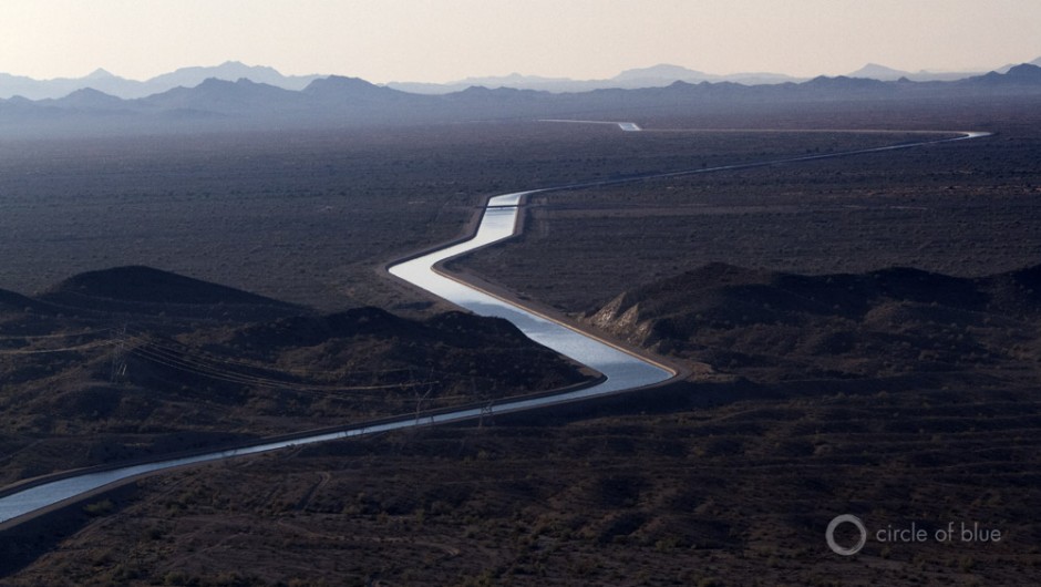
Not far from the magnificent canyons of American lore, the Colorado River’s new course is being carved out of figures and formulae. These calculations determine the future for the 40 million rural folks and city dwellers in the Wild West’s desert civilization who use water from the Colorado, as well as for the millions who benefit from its cheap hydroelectric power.
Every month, officials at the federal Bureau of Reclamation, the dam-master for the river, run some hydrological assumptions and observations through a computer, peer into the crystal screen, and see a rough outline of the system’s health for the following two years. The 24-month study, as it is called, has taken on greater significance since 2007, when the seven U.S. states that share the Colorado River signed an agreement that declared the study as the guidepost for how to operate the Basin’s two big reservoirs, Mead and Powell, in times of water surplus and water deficit. (The 2007 shortage-sharing agreement, known formally as the Colorado River Interim Guidelines for Lower Basin Shortages, did not include Mexico, which is guaranteed water from the river under a 1944 treaty. Mexico’s obligations during a shortage were worked out in an amendment called Minute 319, signed last November.)
Every year since the shortage-sharing agreement was signed, the August study — the 2013 version of which will be released this Friday — has been the standard-setter. Its projections determine how much water the Bureau will send downstream in the next year. If the results from last month hold, as is likely, the amount of water released from Lake Powell in 2014 will be the lowest since the reservoir was being filled during the 1960s. The resulting 9 percent cut would set the table for the first-ever shortage declaration on the Lower Colorado River, either in 2015 or 2016. By then, the water level in Lake Mead, downstream from Powell, is projected to drop below a trigger point that sets off a round of restrictions on water withdrawals for Arizona, California, Nevada, and now Mexico.
— J.C. Davis, spokesman
Southern Nevada Water Authority
Already there are more claims to water than the river can supply, and Mead and Powell are both less than half full. Even worse, climate experts warn that a warming globe will increase evaporation rates and dial down rainfall. The Bureau of Reclamation, in a landmark study of the river’s supply and demand published last December, forecasted an average 9 percent drop in runoff within the Basin by 2060. At the high end, other studies warn that a decline of 30 percent is possible by mid-century.
“We’re staring down the barrel of something bad,” J.C. Davis told Circle of Blue. Davis is spokesman for the Southern Nevada Water Authority (SNWA), which supplies water to Las Vegas, some 90 percent of which comes from the Colorado River.
Yet, if Lake Mead were to fall below 327.7 meters (1,075 feet) in elevation, thus breaching the first of three shortage levels named in the 24-month study, the short-term effects would not be devastating: there would be a belt-tightening by a small group of users in Arizona and Nevada, a price increase for a larger group in Arizona, and a firm cap on withdrawals in California. In practice, water use would likely remain constant, because groundwater pumping — itself an unsustainable safety net — would rise to offset the restriction on surface diversions.

This Is How It Goes Down
The first number to watch for is 1,089.7 meters (3,575 feet). If Friday’s study projects that Lake Powell’s elevation will fall below the 3,575-feet barrier in January of 2014 — as the July study showed — then a shortage for the Lower Basin is all the more likely by 2016, because of the smaller slug of water that the Bureau would release from Powell. Shortages, however, are declared based on Lake Mead’s elevation and would affect only Arizona, California, and Nevada.
Bruce Williams, who works for the Bureau’s river operations group, says that dry soils and below-average rainfall for 2013 point to a similar forecast for this month’s study as was predicted last month.
“Based on everything going on in the Basin, the odds are that July is close to what we’ll see in August,” Williams told Circle of Blue.
If that happens, then attention turns to Lake Mead. The 2007 shortage-sharing agreement sets three reservoir elevations under which water restrictions are imposed on the Lower Basin: 1,075 feet, 1,050 feet, and 1,025 feet. Under the first shortage level, total water use is cut by 4.4 percent in the three Lower Basin states: Arizona would take an 11 percent cut and Nevada 4 percent, while California’s allocation would not be reduced. Mexico’s deliveries would take a 3.3 percent hit.
Arizona’s Story
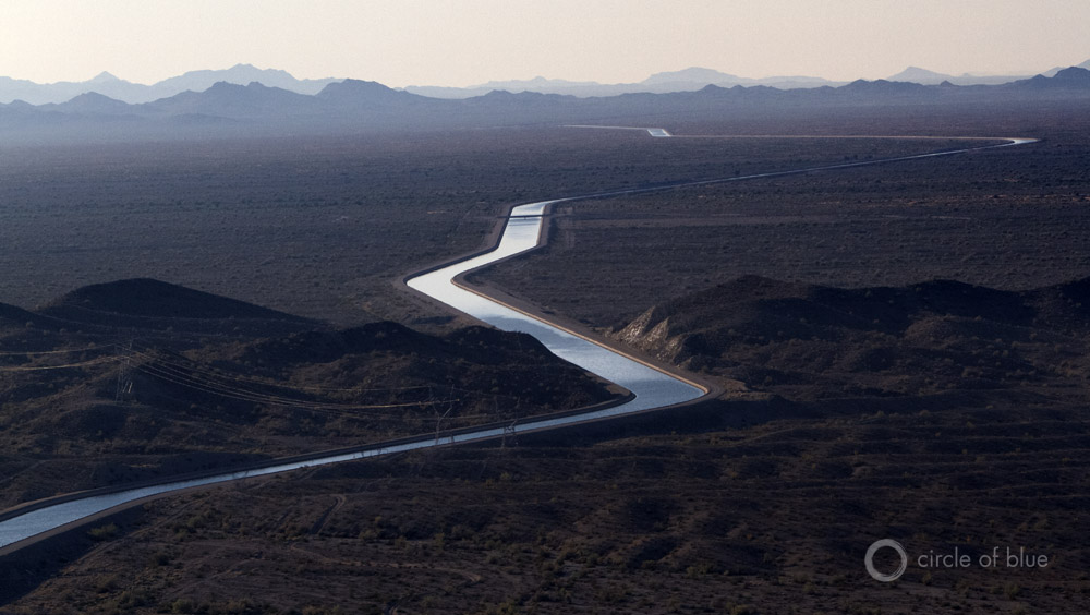
Arizona’s cut would be divided among two tiers and several sub-categories of haves and have-nots. The main tiers are the rights holders along the river and those who take water from the Central Arizona Project (CAP), the 541-kilometer (336-mile) canal that pumps part of the Colorado River into the heart of the state.
Riverside users will see little practical effect of a shortage, because they are not currently using their full entitlement to the river, says Tom McCann, a CAP assistant general manager of planning, engineering, and resources. Rather, the burden of restrictions — which will be offset with water from other sources — falls largely on the canal, because of the hardball politics required to build the conduit.
Authorized by Congress in 1968 and completed in 1993, CAP was designed to move Colorado River water to the state’s soon-to-boom Sun Corridor, from the Phoenix conglomeration all the way to Tucson. To get the project approved over the opposition of politically powerful California and its Congressional battalion, Arizona agreed that CAP would take the lowest priority water rights in the Lower Basin. Thus, it is at the head of the line for the steepest cuts in the case of a shortage.
Like a worker taking a pay cut, CAP’s first order of business will be to reduce its savings rate. Arizona has rights to 3.4 billion cubic meters (2.8 million acre-feet) from the Colorado River, but the state is not using of all it; a good portion is stored underground, where less evaporates than would in the dry desert air. This water bank, holding nearly 4.9 billion cubic meters (4 million acre-feet), will help municipal customers weather a shortage for a while.
“For the next 15 to 20 years, we would not expect a shortage to have any effect on our cities,” McCann told Circle of Blue.
For CAP users, the general immediate effect is this: everyone will pay more for water, and some will have to use less Colorado River water — but not necessarily less water altogether.
That is because the agency that manages the canal has fixed annual costs — an operations and maintenance budget, as well as debt payments for the $US 4 billion project. The agency sets its water rates to cover these costs. If it has fewer units to sell because less is flowing into the CAP, the cost per unit will rise.
Doing a back-of-the-envelope calculation, McCann estimates that rates would rise by roughly one-quarter to cover the $US 25 million revenue shortfall. But the actual increase would depend on how far CAP dips into its rate-stabilization fund and if the state wants to subsidize the more-expensive water.
— Tim Barnett, scientist
Scripps Institution of Oceanography
Unlike cities or tribes, who have top-priority rights to CAP supplies, farmers in central Arizona who use the canal will be the ones to see their pool of water diminished. Every irrigation district operates under different circumstances, but most will look to pump water from aquifers to compensate for less river water.
Brian Betcher, the general manager of the Maricopa-Stanfield Irrigation District, told Circle of Blue that his district, located 64 kilometers (40 miles) south of Phoenix, is rehabilitating old wells to prepare for a shortage. Some 300 wells exist, but only 140 are working. Before CAP was built, the district irrigated its cotton and pecan fields solely with groundwater.
One of the justifications for the canal, of course, was to move the state away from unsustainable groundwater use and to top off exhausted aquifers with surplus Colorado River water. Arizona’s alluvial aquifers showed some of the highest depletions in the American West over the 20th century, according to the U.S. Geological Survey. The effect on the state’s aquifers from a renewed period of groundwater extraction would depend on the length and severity of a shortage.

Nevada’s Story
Nevada has a relatively tiny claim to water from the Colorado River — Arizona’s share is almost 10 times greater, and California trumps Nevada’s claims by 15 to one. When the water was being doled out in the 1920s, Nevada did not have the demands from Las Vegas, which grew rapidly a few decades later and now takes almost all of the state’s Colorado River allocation.
The Southern Nevada Water Authority, the regional wholesaler, is in a position to weather a short-term reduction, because of water-conservation measures, said SNWA spokesman J.C. Davis. The bigger threat, he said, is the long-term decline of water levels in Lake Mead, SNWA’s main reservoir. The authority is now building a third pipe into the reservoir to draw water from depths below 304.8 meters (1,000 feet) in elevation.
“It’s a race against time for that project,” which should be completed by early 2015, Davis told Circle of Blue. SNWA also wants to build a separate 418-kilometer (260-mile) pipeline to move groundwater from four basins in central Nevada that are not connected to the Colorado River.
The Bureau of Reclamation, for its part, is working to keep the river’s hydroelectric workhorse functioning. Much of the electricity that the Colorado River produces comes from Hoover Dam, the wall of concrete just outside of Sin City that holds back Lake Mead. New turbines that are designed to operate at lower lake levels and wicket gates that minimize water losses are currently being installed. Together with efficiency improvements in the control systems, these modifications are squeezing as much energy as possible out of every molecule that flows through the powerhouse.
California’s Story
And then there is California. Under the shortage-sharing agreement, the Golden State does not see a reduction in its allocation in any shortage scenario. If Mead drops to 1,075 or 1,050 or even 1,025 feet, farmers and cities from Imperial County to Los Angeles would still get 5.4 billion cubic meters (4.4 million acre-feet) of Colorado River water annually. Their withdrawals from the river, however, may decrease a bit.
A policy known as “inadvertent overruns” will be suspended during a shortage. The overruns are extra water that flow through the system and push a state’s diversions above what it is entitled to. California, at the end of the river in the United States, has traditionally exploited these flows.
“We’re not subjected to cutbacks [under the shortage-sharing agreement], but we’ll have a hard limit,” Tina Shields, manager of Colorado River resources at Imperial Irrigation District, told Circle of Blue. Imperial, the largest single user of Colorado River water, would feel the pinch: it diverted a net 234 million cubic meters (190,000 acre-feet) above its allocation in 2011 and 2012, and it began “paying back” its excess this year, as is required under the rules of the river, through a bundle of conservation measures.

Endgame
All the trend lines in the Basin point to a shortage in the near future. Recognizing this, the seven Basin states have taken small steps to assess their water challenge. Though these debates about supply are profoundly unromantic — a river collateralized — they are necessary and consequential as the Colorado plunges inevitably toward shortage.
Brad Udall, director of the Getches-Wilkinson Center for Natural Resources, Energy, and Environment at the University of Colorado Law School, says that the Interior Department’s Basin study, completed last December with the cooperation of the Basin states, is a first attempt at a long-term management plan for the Colorado River. The study recommended a number of ways to decrease demand and increase supply. Three stakeholder committees are expanding on that work and are preparing reports on conservation measures for the municipal, industrial, and agricultural sectors.
Conservation is the cheapest way to cut demand, according to the study, but two other paths — transfers and augmentation — will be most controversial.
— Tina Shields, manager of Colorado River resources
Imperial Irrigation District
Since agriculture consumes roughly half the water in the Basin, many cities look to the farms for new supplies. There are currently several fallowing programs in California that pay farmers not to farm, then transfer the saved water to metropolitan areas. But irrigators are leery of too many transfer programs, which can disrupt rural communities.
“Imperial Irrigation District is not a big believer in jeopardizing our food supply in exchange for swimming pools,” Shields said. “It’s one thing to fallow land for emergency measures and another to dry up farmland so that people in the cities can live high on the hog.”
Augmentation, which means bringing in supplies from outside the Basin and includes projects such as SNWA’s plan to pipe water from central Nevada, may be even more fraught. It promises a parade of lawsuits, yet that will not keep water managers from desiring more supply.
“Down the road, the only solution is to develop new sources of water,” said McCann, of the Central Arizona Project.
As Mead and Powell circle the drain, this chatter will grow stronger. Though a shortage might not immediately change the amount of water used — because of water banks, existing conservation benefits, and groundwater — the greater effect might be psychological, University of Colorado Law School’s Udall argues.
“It’s one thing to talk about hardship and another thing to have to endure it,” he said.

Brett writes about agriculture, energy, infrastructure, and the politics and economics of water in the United States. He also writes the Federal Water Tap, Circle of Blue’s weekly digest of U.S. government water news. He is the winner of two Society of Environmental Journalists reporting awards, one of the top honors in American environmental journalism: first place for explanatory reporting for a series on septic system pollution in the United States(2016) and third place for beat reporting in a small market (2014). He received the Sierra Club’s Distinguished Service Award in 2018. Brett lives in Seattle, where he hikes the mountains and bakes pies. Contact Brett Walton


Brett, great piece, thanks. But nobody uses “hectare-meters” as a unit. Cubic meters is typical when converting from the west’s “acre-feet”. There are 1233 cubic meters in an acre-foot.
Peter, we’ve changed the measurement to cubic meters. However, a few other confused souls do use hectare-meters, at least according to a Google books search.
I know this is a water-based website, but the impact on energy generation will be far greater than the small cutbacks enforced on water consumption. AZ and NV will easily weather lower water allotments. The power customers in the Southwestern US, however, will be shocked when they receive their power bills in 2015. Lower Lake Mead water levels will cause 25-35 percent hydroelectric power generation cutbacks, resulting in power being imported at a premium through inter-ties.
Well, the 24 month report released today (8/12/13) had the estimation that Lake Powell would be under 3575′ in January 2014.
http://www.usbr.gov/lc/region/g4000/24mo.pdf
“Consistent with Section 6.C.1 of the Interim Guidelines, if the August 24-Month study projects the January 1, 2014, Lake Powell elevation to be less than 3,575.0 feet and at or above 3,525.0 feet and the Lake Mead elevation to be at or above 1,025.0 feet, the operational tier for Lake Powell in water year 2014 will be the Mid-Elevation Release Tier and the water year release volume from Lake Powell will be 7.48 maf. This August 2013 24-Month study projects that, with an 8.23 maf annual release pattern in water year 2014, the January 1, 2014, Lake Powell elevation would be 3,573.69 feet and the Lake Mead elevation would be 1,107.39 feet. Therefore, consistent with Section 6.C.1 of the Interim Guidelines, the Lake Powell operational tier for water year 2014 is the Mid-Elevation Release Tier with an annual release volume of 7.48 maf.”
We need a wet and snowy Western Rocky Mountain winter this year, in the worst way.
What happens to 4th Priority CAP water users that have approximately 32,000 acre-feet/year if there is a drought?
http://www.azwaterbank.gov/documents/2006/Directors_Workgroup_recommendations.pdf
This was the Arizona Water Bank’s recommendations in 2006.