EPA Report Identifies Hot Spots for Hazardous Spills Into Drinking Water Sources
Agency finds “significant risk” nationally for toxic emergencies.

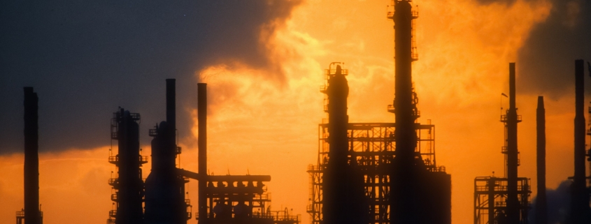
A chemical plant along the Mississippi River in Louisiana is silhouetted against a glowing sky in this photo from 1988. Louisiana had the fourth-most number of hazardous spills to drinking water sources, according to U.S. Environmental Protection Agency analysis of data between 2010 and 2019. Photo © J. Carl Ganter / Circle of Blue
By Brett Walton, Circle of Blue
The morning of January 9, 2014, regulators at the West Virginia Department of Environmental Quality received complaints of strange odors akin to licorice coming from the Freedom Industries chemical storage facility, in Charleston.
When inspectors arrived on site, they found two holes at the bottom of tank 396. The holes, no wider than a nickel, allowed about 11,000 gallons of crude MCHM, a coal washing chemical, to flow into the adjacent Elk River.
Less than two miles downstream of the spill was the intake for West Virginia American Water, the operator of Charleston’s drinking water system. Owing to confusion about the nature of the chemical, crude MCHM slipped into the utility’s distribution network, resulting in 300,000 residents in nine counties being told not to use their tap water. The do-not-use order, for some residents, lasted nine days.
The Freedom Industries spill is one of many incidents detailed in a new U.S. Environmental Protection Agency report that is the most comprehensive assessment to date of the number, location, and characteristics of chemical and toxic spills into U.S. drinking water sources.
Using a combination of federal data sets covering the years between 2010 and 2019, the assessment found 3,931 incidents of toxic spills into groundwater, rivers, or lakes used for drinking water. The spills occurred in the vicinity of 15 percent of the country’s drinking water intakes that draw from surface water but in less than 1 percent of groundwater wells used as a public supply source. A spill in the vicinity does not necessarily mean that drinking water was compromised.
“The findings from this study demonstrate there is a significant risk of releases into sources of drinking water at a national scale,” according to the report. “However, the risk to a community water system will depend on their unique circumstances.”
The EPA did not make the report author available for an interview but the agency noted in a statement that the risk of contamination varies across individual water systems.
Outside experts said that the report is an important contribution to understanding contamination risks to drinking water.
“I don’t think there’s ever been an aggregation of the data in this manner before,” Kevin Morley of the American Water Works Association, an industry group, told Circle of Blue.
Spills occurred in every state, but certain regions exhibited more failures. The largest number of incidents were concentrated around transportation routes, mining and drilling sites, and industrial hubs. Those areas include the Ohio River Valley, Mississippi Delta, Los Angeles area, oil and gas belts of Oklahoma and Texas, and Interstate 95 corridor in the Northeast.
States with the most incidents were Texas (303), California (244), Oklahoma (236), Louisiana (205), and Pennsylvania (169). Osage County, Oklahoma, an oil and gas hub, alone accounted for 117 incidents.
More than half the incidents were small, meaning spills of less than 1,000 gallons. Large spills like the release of millions gallons of coal waste into the Dan River in North Carolina in 2014 were infrequent.
Equipment failures (27 percent) were the leading cause of spills, and private industry was most often the responsible party.
Out of the 840 hazardous substances that were documented in the decade of spills, more than half the incidents were related to discharges of refined oil.
These details add up to a clearer picture of risks to drinking water, said Alan Roberson, the executive director of the Association of State Drinking Water Administrators.
“The idea is that utilities will be better informed about what’s upstream,” Roberson told Circle of Blue.

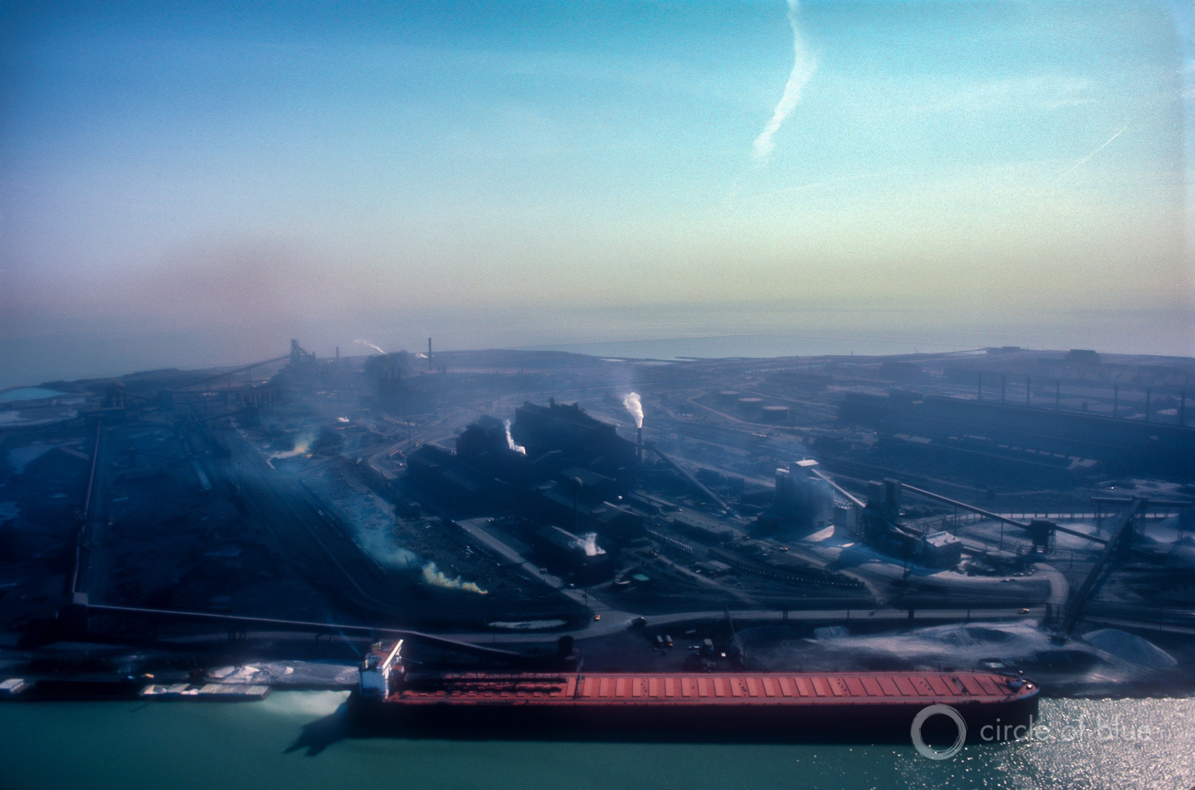
The former Inland Steel site along the Grand Calumet River where it meets Lake Michigan in East Chicago, Indiana. Photo © J. Carl Ganter/Circle of Blue
Assessing Risks
Congress, in 2018, passed the America’s Water Infrastructure Act. Several provisions in the act were in response to the Freedom Industries spill and were intended to provide community water systems with more information about threats to drinking water, like the tanks of crude MCHM sitting upstream from Charleston.
West Virginia American Water knew that the chemical storage tanks were a risk. But the utility did not know what chemicals they stored, according to the U.S. Chemical Safety and Hazard Investigation Board.
The America’s Water Infrastructure Act was designed to lift that ignorance. The act allows community water systems to access hazardous chemical data collected under federal law that previously had been available mostly to fire departments and emergency responders. The act also requires that water systems receive prompt notice of a spill.
The report recommends that utilities use the powers granted by the 2018 act to catalog facilities that could prompt an emergency and identify the chemicals they use. Then utilities should make contact with facility owners to establish lines of communication for direct contact during an emergency. Utilities should identify labs that can test for the chemicals in question. They should plan how to protect an intake and whether their treatment process can remove hazardous materials that might be spilled.
“It’s all about the time,” Morley explained. “The more time, the more options I have.” Instead of scrambling to learn the characteristics of a spilled substance and reacting on the spot, utilities can write those details into emergency response plans that the 2018 act also requires.
The EPA said it briefed national water associations on the report and shared its findings to utilities via webinars and conferences.
The report examined spills that were reported to the National Response Center, a clearinghouse, between 2010 and 2019. The report includes spills that occurred in waters used as a drinking water source for community water systems serving more than 1,000 customers. For systems using surface water, the “zone of concern” extended 50 miles upstream and a quarter mile downstream of a drinking water intake. For groundwater systems, the zone was a half-mile radius around a well. Spills of less than 100 gallons were excluded from the analysis, except in the case of arsenic, cyanide, pesticides, and other highly toxic materials.
The report is useful in other ways, Morley said. It demonstrates that this sort of risk analysis — combining the locations of chemical facilities and drinking water intakes and wells — is possible for other laws like the Toxic Substances Control Act and Clean Water Act that require similar spatial assessments.
“This shows that EPA does have the capability,” Morley said.
Brett writes about agriculture, energy, infrastructure, and the politics and economics of water in the United States. He also writes the Federal Water Tap, Circle of Blue’s weekly digest of U.S. government water news. He is the winner of two Society of Environmental Journalists reporting awards, one of the top honors in American environmental journalism: first place for explanatory reporting for a series on septic system pollution in the United States(2016) and third place for beat reporting in a small market (2014). He received the Sierra Club’s Distinguished Service Award in 2018. Brett lives in Seattle, where he hikes the mountains and bakes pies. Contact Brett Walton


Leave a Reply
Want to join the discussion?Feel free to contribute!