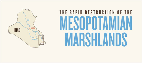
Map: Destruction and Restoration of Iraq’s Mesopotamian Marshlands (1973-2013)
Saddam Hussein’s legacy includes draining Iraq’s Mesopotamian Marshland, an integral part of the Tigris-Euphrates River Basin and once the third-largest wetland in the world. Now, the Biblical Garden of Eden is the site of the war-weary nation’s first and only national park.
Situated between the Tigris and Euphrates rivers, Iraq’s Mesopotamian Marshlands have witnessed a turbulent two decades. The map below shows changes over time to the extent of the marshes. In 1973, the first satellite images revealed that the marshlands covered an estimated 10,500 square kilometers (4,050 square miles). The map also chronicles how Saddam Hussein’s systematic draining of the marshlands in the early 1990s — a massive engineering project to prevent the Tigris and Euphrates rivers from supplying water to the marshes — radically altered the natural landscape of central Iraq. By 2000, the marshes had shrunk to one-tenth their 1973 extent. Since 2003, when Saddam’s reign ended, international efforts to re-flood the marshes have seen tangible results, partially restoring this natural wonderland, full of ecological and archeological treasures.
However, agricultural overuse upstream has reduced the flow of Tigris and Euphrates rivers, and 36 current dams in Iraq, Iran, Syria, and Turkey — plus 21 dams planned for the next decade — have ended the seasonal floods that once sustained one of the world’s oldest civilizations. The end of the floods threatens not only the hydrological and biological health of the marshes, according to experts, but could also trigger agricultural collapse in Iraq.
Permanent marshes denote areas covered by water and marsh vegetation for three or more years, edge marshes are covered four to 10 months each year, and seasonal marshes are covered less than four months each year. Click the image below to learn more.

Map produced by Kalin Wood, a Washington, D.C.-based former Circle of Blue intern who now works for LivingSocial. Additional contributions from Circle of Blue news editor Aubrey Ann Parker (circleofblue.org/contact) and Joanne (Yuan) Yao, a Circle of Blue intern and PhD student at the London School of Economics (LSE). Special thanks to Weston Anderson, a senior research assistant at the International Food Policy Research Institute in Washington, D.C., and Keith Holmes, a scientist at the Spatial Pattern Analysis and Research Laboratory at Canada’s University of Victoria, for their help with satellite imagery and GIS maps of the marshlands. This infographic was made to accompany Yao’s article, Iraq’s First National Park: A Story of Destruction and Restoration in the Mesopotamian Marshlands .





Leave a Reply
Want to join the discussion?Feel free to contribute!