Where Energy Development Puts Rivers at Risk
American Rivers’ annual tally of threatened rivers highlights effects of drilling for natural gas.
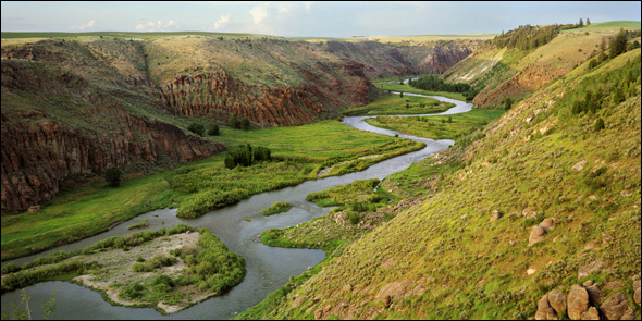
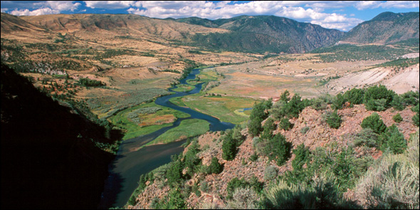
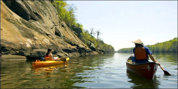
The Teton River is one of the 10 most endangered rivers in the U.S., according to the annual national assessment released on Wednesday by American Rivers. A new dam on the river threatens many species, including the Yellowstone cutthroat trout, which has been proposed as an endangered species by officials on several occasions.
By Heather Rousseau
Circle of Blue
Natural gas development, outdated flood management and dams are the biggest threats to the 10 most endangered rivers in the U.S., according to the annual national assessment released on Wednesday by American Rivers.
The 2010 edition of the report, America’s Most Endangered Rivers, found that two of the 10 most endangered rivers, the Upper Delaware and the Monongahela, are threatened by natural gas drilling in watersheds that both drain into New York and Pennsylvania.
With the Deepwater Horizon oil blowout unfolding in the Gulf of Mexico and with new understanding of the risks of natural gas development in domestic watersheds, American Rivers is joining a number of other national conservation groups in pressing the Obama administration and Congress to provide the federal government with more authority to regulate the industry.
On Thursday, Senate Majority Leader Harry Reid sent a letter urging six Senate committee chairs to prepare for a debate in July on new energy legislation, saying that he was prepared to see much tougher oversight of energy developers.
“Among the actions we need to explore are ensuring that the oil companies’ are held accountable for the damages caused by their operations,” wrote Reid, a Democrat of Nevada.
American Rivers is most concerned with the energy development process of hydraulic fracturing, which is the use of water and chemicals, pumped under pressure into drilling shafts, to fracture rock and provide spaces through which natural gas flows to the well. It has been linked in seven states to contamination in aquifers, though the industry asserts that decades of experience with “hydrofracking,” as its commonly known, is safe.
The U.S. Environmental Protection Agency in March launched a comprehensive analysis of hydrofracking that will update a report on the process it finished in 2004, when the agency said it was not a threat to drinking water.
“This is the first year we have put a river on the list for the hydraulic fracture process,” said Amy Kober, communications director for American Rivers. “I think we really need to take a hard look and make sure we have restrictions and safeguards in place on gas drilling so it can be done safely.”
In addition to man-made influences, increased floods, droughts and water pollution related to climate change have further complicated the health of rivers.
“These rivers are all at a crossroads, there is a major decisions hanging over them that will determine their fate.” Kober told Circle of Blue, “We want people to be weigh in and make a difference.”
The 2010 threatened rivers report is the 25th published by American Rivers. The principal threats identified by American Rivers have evolved in that time span from dams and logging in the 1980s, to urban and suburban development in the 1990s. This year’s report is the first to identify drilling practices as the primary risk to rivers, and is consistent with escalating environmental and human costs of satisfying the nation’s insatiable demand for fossil fuels.
“When a river is endangered the community that depends on that river is endangered,” said Kober.
Here’s a look at the top 10 most endangered rivers in the U.S.:
#1 Upper Delaware River, Pennsylvania, New York
Wastewater produced by chemicals that are injected into the ground during the extraction of natural gas is threatening the Upper Delaware River. Seventeen million people from Pennsylvania and New York State acquire their drinking water from the river, which is also home to the bald eagle. In 2007 the river made the list as the fourth most endangered because it was threatened by a potential power line. The project was eventually moved out of concern for the river’s health.
Currently, there is no adequate plan to treat what is projected to be 109 million gallons of wastewater a day from natural gas development by 2011.
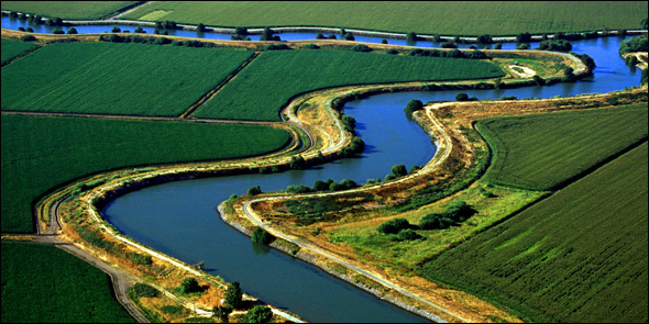
#2 Sacramento-San Joaquin River Delta California
Outdated water supply and flooding management systems have devastated the ecosystem of the Sacramento-San Joaquin River Delta, and closed the commercial salmon fishery. As a result, Californians are left more vulnerable to droughts and floods.
Sacramento-San Joaquin River Delta supplies drinking water for 25 million people and irrigates some of the most productive agricultural land in the U.S., according to American Rivers. Meanwhile 95 percent of flood plain and freshwater tidal marsh have been eliminated due to dams, levees and agricultural development in the area. The river once supported millions of salmon. Now the remaining fish, as well as millions of migratory birds, elk and grizzly bear are threatened.
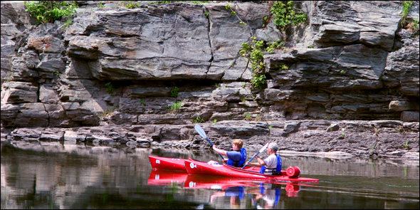
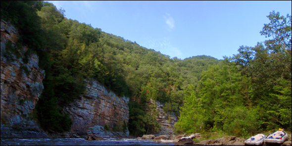
#3 Gauley River, West Virginia
The Gauley River runs 107 miles from the mountain streams in the Monongahela National Forest. American Rivers reports that mountaintop removal done during coal mining threatens the $16 million recreational industry along the Gauley River. The report also notes that the EPA proposed new water guidelines in March 2010 to control the mining under provisions of the Clean Water Act. Coal mining and timber activities have resulted in buried streams, debris and polluted water for Appalachian residents.
#4 Little River, North Carolina
A proposed dam threatens the now healthy habitat of the Little River, which is the home of several endangered fish and mussel species. In addition to providing drinking water for 50,000 people the river also provides irrigation for farms and is used for fishing and paddling. According to American Rivers, the proposed dam would cover 1,150 acres and store more than 3.7 billion gallons of water. Hundreds of acres of wetlands would be submerged and could no longer offer flood protection, while restoration work that has been done for migratory fish would be ruined. American Rivers asserts that the proposed dam is too expensive and not resourceful. The group recommends that Wake County, where the river is located, to introduce water efficiency programs and look into the Falls Lake reservoir to expand supply.
#5 Cedar River, Iowa
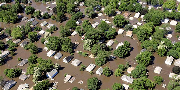
Pollution and increased flood damage caused by urbanization, extensive agriculture and flooding have caused health as well as safety issues in the communities around Cedar River. But updating flood protection and sustainable farming methods would help correct the dramatically increasing river flow.
A tributary of the Mississippi, Cedar River provides support for a variety of fish and wildlife as well as endangered mussels and rare plant communities. Outdoor recreation is prevalent on the river, which also provides drinking water for more than 120,000 people.
#6 Upper Colorado River, Colorado
For more than a century water diversions drained the Upper Colorado River to dangerously low levels. More proposals for water withdrawal threaten the river’s ability to sustain its fisheries, whitewater recreation, wildlife and tourism. American Rivers also reports that species living in the river have declined in number as the river’s temperature has risen. Currently there are two projects for water withdrawal being reviewed by the Bureau of Reclamation and the U.S. Army Corps of Engineers, which, if approved, could reduce the water flow to unsustainable levels.
#7 Chetco River, Oregon
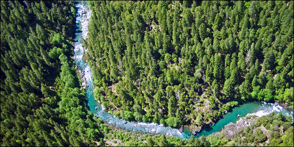
Proposals to mine more than half of the 44.5 miles of the Chetco River for gold would threaten the successful reproduction of salmon and diminish water quality. Gasoline-powered suction dredges would upset the gravel and rock at the bottom of the river, disturbing its ecosystem. Chetco River is located in southern Oregon and provides an abundance of wild salmon and steelhead trout. The 14,000 residents of Brookings-Harbor drink exceptionally pure and clean drinking water that would be compromised by the mining. The in-stream mining may begin as soon as July 15, 2010.
#8 Teton River, Idaho
A new dam on the Teton River threatens many species, including the Yellowstone cutthroat trout, which has been proposed as an endangered species by officials on several occasions. The river’s abundant wildlife and Idaho’s multi-billion dollar farming industry are also threatened if the plan for rebuilding the Teton Dam is implemented, according to American Rivers.
#9 Monongahela River, Pennsylvania, West Virginia
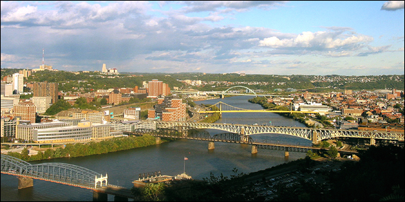
The Mononghela River begins in northwest Virginia in the Monongahela National Forest. Energy companies have fractured the shale in the rivers to extract natural gas through hydraulic fracturing. Hydrofracking adds to the burden of abuse the river already has sustained from coal mining pollution.
#10 Coosa River, Alabama
A variety of rare fish, rare freshwater snails and mussels live in the Coosa. The river is also used for power generation, agriculture, recreation and drinking water. Seven hydropower dams split the river apart. American Rivers reports that the dams caused the largest mass extinction of wildlife in U.S. history in the 1900’s. The group suggests that further assessment of these dams needs to be done to protect the remaining fish and wildlife.
Heather Rousseau is a reporter and photojournalist for Circle of Blue. Reach her at circleofblue.org/contact.







Leave a Reply
Want to join the discussion?Feel free to contribute!